meteokav.gr Forecast Graph

This graph represents the most recent forecast model run of WXSim
Model runs at 09:00 (effective 09:00-03:00) and 03:00 (effective 03:00-09:00).
GraphCast Interpretation
Top Graph
| Temp. °C | The "24hr" temperatures are the low and high values from midnight to midnight. |
| AM/PM temps are defined as follows: Min is from 7PM the preceding day until 7AM of the current day. Max is from 7AM through 7PM of the current day. Usually, the two types of reports give the same results, but in winter, with fronts moving through, there will be differences. NWS forecasts use the AM/PM system (as do these forecasts), but the official climate data is generally midnight-to-midnight. |
| Dew Pt °C | Dew Point is the temperature at which the air can now longer hold all of its water vapor. |
| DP is a better indicator over Humidity of how muggy or dry it feels. |
| 850 hPa | This temperature shows weather conditions at around 5000ft above sea level. |
| Forecasting Surface High using the 850hPa Temp and SkewT. |
| Temp Adv | Refers to change in temp caused by movement of air by the wind. |
| Forecasting temperatures using advection involves looking at the wind direction at your forecasting site and the temperatures upstream (in the direction from which the wind is blowing). If temps are warmer, that means warmer air is being transported towards your station and the temperature should rise. |
Bottom Graph
|
Used to assess instability of the middle troposphere. The more -ve the LI the more unstable the troposphere and the more buoyant the acceleration will be for rising parcels of air. Only use LI for warm season convection. Not recommended for forecasting winter precipitation. CAPE (using the SkewT) is better at assessing instability in the troposphere as a whole. |
|
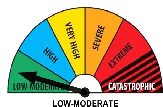
Used to assess convective potential. Should not be used to determine severity of storms. This index works best for flat areas in low to moderate elevations. It does not work for high elevations. |
|
TT (Total Totals) is used to assess storm strength. This index works best for flat areas in low to moderate elevations. It does not work for high elevations. Index will be too stable if a layer of moisture is just under the 850 hPa level. |
Note: Getting to Know SkewT Parameters.